FORT IRWIN, Calif. — In the summer of 1965, a newly minted U.S. Army second lieutenant and his new bride began an adventure that would bring them to a remote desert Army post for his first assignment as a military officer.
2nd Lt. Michael Naylon and his new wife, Beverly, left White Plains, N.Y., in late June headed for his first Army assignment at Fort Irwin in sunny Southern California.
Their trip would take them first to Chicago, where they would find the beginning of the “Mother Road,” U.S. Route 66.
The Naylons would follow Route 66 all the way from Chicago to Santa Monica, Calif., the full distance of 2,448 miles. Once they reached the end of the road, they turned east and back-tracked to Barstow, then on to Fort Irwin, about 35 miles north of the dusty, desert railroad town.
Along the road, sometimes referred to as America’s Main Street, the Naylons would stop at all the usual tourist stops, collecting brochures and literature as keepsakes to remember their long trek.
Although the young Army officer and his new bride didn’t realize it, their experience would be shared by millions of other motorists that would use the road to traverse a major part of the country.
Route 66 was established in November 1923, but the origins of the road go back much further, and run much closer to Fort Irwin.
In 1857, the U.S. Army commissioned Edward Beale to survey parts of the Southwest and establish roadways between New Mexico and Southern California. Much to Beale’s dismay, the Army insisted that he use camels as part of an experiment on the use of camels in Army operations.
Despite Beale’s initial hesitation, the camels proved to be up to the challenge of desert travel and withstood the hardships better than the Army’s horses and mules.
Beale’s travels would take him through what is now Fort Irwin and roughly followed the path later established as Route 66. Although the camel experiment was successful, the U.S. Congress stopped funding for the camels and the Army sold off the remaining herd.
In February 1908, six automobiles left New York for an around-the-world auto race to Paris, France. Starting in Times Square, the drivers headed to Chicago, then to San Francisco. Next they were to head north to Alaska, cross over into Russia, and drive to the Eiffel Tower in Paris.
The mayor of Los Angeles encouraged the drivers to take a more southern route and leave the dusty trails of the Mojave Desert in favor of the improved roads in the Los Angeles area.
One of the cars, the Italian automaker Zust’s entry, broke from the path taken by the other automobiles as they were leaving Death Valley and entered what is today the National Training Center at Cave Springs. They would pass Bicycle Lake and head to the town of Daggett, just east of Barstow.
After spending the night in Daggett, they would leave the desert on April 1. They took the roads that would form Route 66 in California, into San Bernardino and then west to Los Angeles. The Zust would be one of three automobiles to complete the journey, but in spite of the promises of the mayor of Los Angeles, the improved roads were not enough to allow the Zust to catch up with the American Thomas car. The Italians finished the race in third place.
The design of Route 66 was intended to connect the main streets of towns along its path to create the first true interstate highway.
Although all but destroyed when the Interstate Highway System was developed in 1956, the spirit of the Mother Road lives on. Many of the landmarks that once entertained travelers along the road are gone, plowed under in the name of progress. However, efforts to save what is left of the road and the attractions are succeeding.
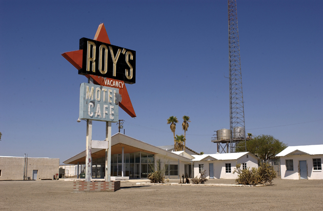
Within a few hours of Fort Irwin, there are many of the old attractions and restaurants that served the traveling public.
The Route 66 Museums in Barstow and Victorville allow a glimpse into the lives of travelers in the heyday of Route 66. Attractions from the ghost town at Oatman, Ariz. to the Santa Monica Pier can easily be part of a short day trip off the installation.