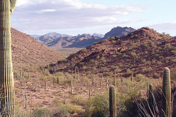
The Barry M. Goldwater Range complex is a vast training range for U.S. and allied pilots. The range consists of 1.7 million acres of relatively undisturbed Sonoran Desert southwest of Luke Air Force Base between Yuma and Tucson, south of Interstate 8. Overhead are 57,000 cubic miles of airspace where pilots practice air-to-air maneuvers and engage simulated battlefield targets on the ground. Roughly the size of Connecticut, the immense size of the complex allows for simultaneous training activities on nine air-to-ground and two air-to-air ranges.
The Luke Air Force Base 56th Range Management Office manages the eastern 1.05 million acres of the Range, known as BMGR-East. Marine Corps Air Station Yuma oversees operations on the western portion of the range.
The range has played an integral role in the flying mission at Luke since both the Gila Bend Auxiliary Air Field and the range were constructed in 1941. In the early years, it provided training for aircraft from both Luke and Williams air fields. During World War II, the range complex consisted of a ground gunnery layout of five aerial ranges, measuring about five miles by 35 miles. Today, the range is within the unrefueled flight radius of 12 military installations and the U.S. Pacific fleet carriers. Combat pilots from the Army, Navy, Marine Corps and Air Force — active duty, Guard and Reserve — use the range to hone their skills.
The land that makes up the gunnery range was withdrawn from public use by Executive Order 8892, which was issued by President Franklin D. Roosevelt on Sept. 5, 1941. More than 70 years of military training has insulated the range from intensive human intrusion. Only about 6 percent of the land is intensively used for roads, targets and support areas. The remaining 94 percent is relatively undisturbed Sonoran Desert, which thrives under natural conditions. Flora and fauna flourish and the archaeological record of 10,000 years of human activities lies mostly undisturbed. Together, the Goldwater Range complex, the Pinacate Biosphere Reserve in Sonora and the Organ Pipe Cactus National Monument make up the largest unfragmented, protected area in Mexico or the U.S. outside of Alaska.
Military users drop live ordnance on five pinpoint targets, however 98 percent of the weapons dropped in the complex are inert practice bombs. Most of the land is a safety buffer for low-flying fighter aircraft. The safety zones provide refuge-like conditions for the animals, including a number of protected and endangered species, such as the Sonoran pronghorn antelope, cactus ferruginous pygmy owl, flat-tailed horned lizard, and lesser long-nosed bat.
Natural and cultural resource protection is an important part of the Defense Department’s use of the range. As responsible stewards of the lands entrusted to the Air Force, Range Management Office employs an environmental team to protect the habitat included within the boundaries of the complex. Staff biologists and archaeologists, specifically trained in the ecology and culture of southwestern Arizona, have developed comprehensive programs to monitor protected species like the Sonoran pronghorn antelope and to inventory native American cultural sites inside the range’s boundaries.
Before dropping live high explosive bombs on designated impact areas, biologists are sent to ensure there are no pronghorn within five kilometers of a target. If there are animals present, missions are either redirected or canceled.
To protect the range’s remnants of the past, care has been taken to avoid disturbing or destroying significant cultural resources during ground activities by the military or the public. Special protection is provided for archaeologically significant sites and surrounding areas that could be impacted by both the military and the public.
The range is filled with reminders of more than 10,000 years of civilization, including pottery sherds, prehistoric settlements, ancient roads and trails, abandoned mining operations, and historic and prehistoric gravesites. The range also contains a historically significant road, the Camino del Diablo, that was listed in 1978 on the National Register of Historic Places. This rough, unpaved road crosses the southern portion of the range and dips into Mexico.
Human settlements have been on the range since 9500 B.C. Prehistoric pottery is not uncommon on the range — fragments are scattered along prehistoric trails, near watering places, along playa edges, and in mountain passes. Pictographs adorn flat rocks in many places.
Because of the high potential for encountering culturally significant objects on the range, surveys are performed by qualified archaeologists at areas where ground activities are planned. If the survey results in significant findings, an alternative location is selected for the planned activity. Additional inventories are being conducted or planned for the Goldwater Range, with the resulting data to be entered into a geographic information system. This system is a management tool which allows mapping of these sites and other significant features of interest.
In addition to cultural preservation, the Air Force collaborates with local partners on protecting natural resources as well. The range is home to the Sonoran Pronghorn, which was federally listed as an endangered species in 1967. The Air Force, Marine Corps, Army National Guard, U.S. Fish and Wildlife Service, and the Arizona Game and Fish Department work together to conserve the remaining subpopulation of the Sonoran pronghorn found on the range.
In 2002, the Sonoran pronghorn population on the range dropped nearly 80 percent, primarily due to drought conditions. Lack of rainfall from mid-August 2001 to the winter of 2002 contributed to the lowest count ever — 21. The Air Force, Marine Corps, Army National Guard, FWS and AGFD partners began planning, funding and implementing emergency recovery measures to reverse the low population trend.
The recovery team hauled in water directly to the animals and constructed a one-square mile semi-captive breeding enclosure. Personnel continue to monitor the animals and patrol the perimeter fence for predator intrusion or other tampering.
Although tight Air Force controls have limited public access and kept the proliferation of off-road vehicles from damaging the fragile desert landscape, most of the range complex can be visited by obtaining a permit. There are several visitor regulations associated with obtaining a permit. These are designed to help protect personal safety of visitors while protecting natural and cultural resources on the range. For instance, all vehicles must remain on existing roads at all times. Regulations require each adult 18 years or older have their own permit in their possession while on the range and must call before they enter and after they depart the range. Permits can be obtained from the Range Offices at Gila Bend Air Force Auxiliary Field and Marine Corps Air Station Yuma, Cabeza Prieta National Wildlife Refuge and the Bureau of Land Management offices in Yuma and Phoenix.